Visit(s): August 2025
Related Trips:
- 11-Day Washington State & British Columbia Itinerary – August 2025
My Mt. Rainier experience has been defined by hiking the Skyline Trail, what felt like the most challenging hike of my life – the only other one in competition is Huangshan in China (see here). It’s native landscape made for the most beautiful walk I’ve taken in my life.
Mount Rainier National Park contains the namesake Mt. Rainier, an active volcano that is park of the Cascade Range. While home to the most glaciated peak in the contiguous US, it also is the home of wildflower meadows, rivers, falls, and rolling hills. There are 5 areas: Longmire (southwest), Paradise (south-central), Ohanapecosh (southeast), Sunrise (northeast), and Mowich (northwest).
description
table of contents: Completing Hiking/Activities, Extension opportunities, Accommodations, Food
photos
content with an h5 header for the table
Trails & Vistas
Longmire
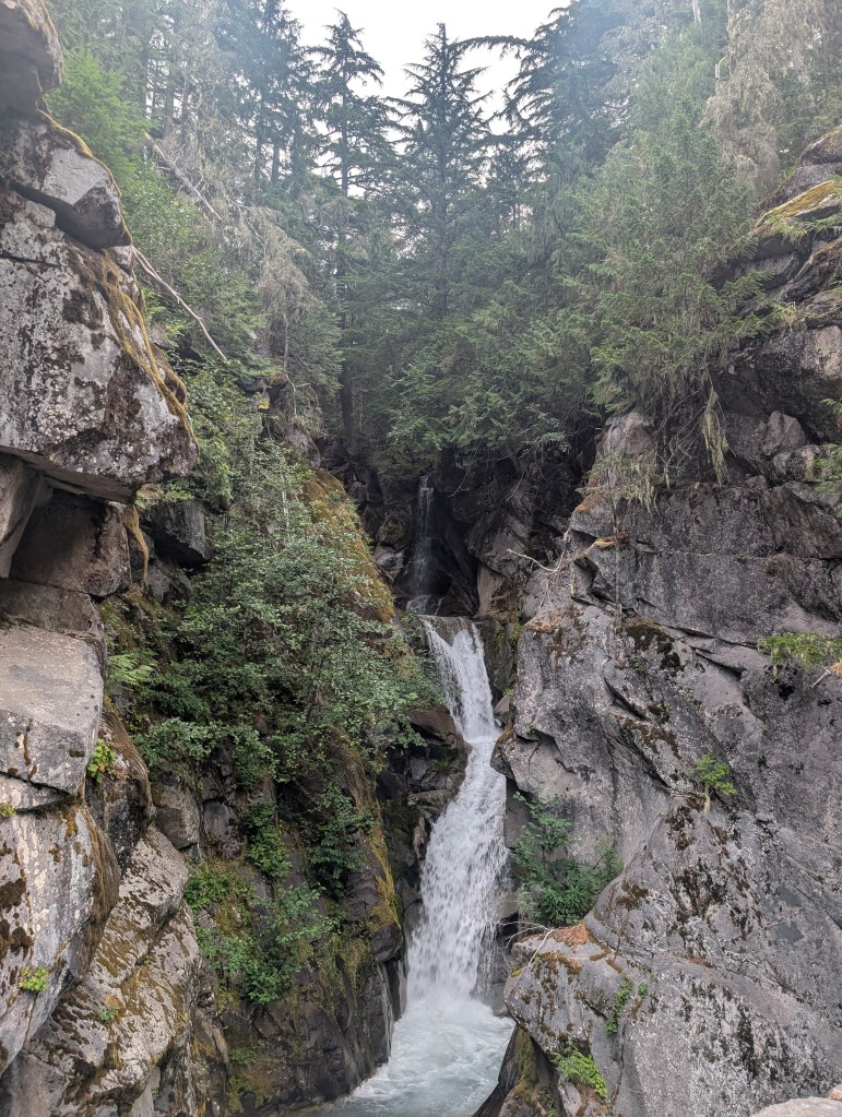
Christine Falls
- Visited August 2025, this was our first stop after the Nisqually Entrance. It took about 2 minutes to get out and take some pictures.
Narada Falls
- Visited August 2025. My brother walked the short 5 minutes down to get a better look, but I was exhausted and happy to look at it from the top. One thing about me is I don’t care for waterfalls, so to be this is skippable. While we stopped at Christine Falls before the Skyline Trail, we wanted to make sure we had good parking, skipped Narada in the morning, and came back after the 5 hour hike.
Paradise
Skyline Loop
- Completed August 2025. This starts off very steep in the beginning – I’m talking 20 minutes. It’s then followed by alternating up and down hills. During the hike, you can you see the glacier as well as vegetation, rivers, waterfalls, wildflowers, and rolling hills at any given moment. I felt like I was living out my 13 year old Pinterest board every 10 minutes. It required ample water and food supply. For amateur hikers like us, that meant Leti was carrying a 1 gallon water jug (remember how steep I said the beginning was) as well as the rest of our food and water on our backs. If this kind of hike something we did regularly, I’d understand the need to get real equipment. We stopped a lot, but it meant we had a lot of time to look around and take in our surroundings. I’d love to do it again.
- AllTrails info: 5.6mi, 1778 ft. elevation, 5 hours, loop, hard
- Myrtle Falls extension: There is a very small detour down to see Myrtle Falls. Leti and I skipped it because we 1) don’t care much about waterfalls and 2) it was raining really hard and felt unsafe to climb down on the rocks.
Paradise Valley Road
- Visited August 2025, this is the main road of the park that overlooks a meadow. It’s use is much like Skyline Drive in Shenandoah, meaning if you just go to Paradise section of the park, you’ll be driving on this.
Reflection Lake
- Visited August 2025, this is a big lake that could be good for lunch or painting. This was a pit stop on our drive after the Skyline Loop Trail. We found it to be crowded along Stevens Canyon Rd – maybe if we could walk around to the other side, it would be more peaceful.
Ohanapecosh Area
Did not do at all
For our August 2025 trip, we prioritized Paradise and Sunrise, meaning we stayed in Ashford (as opposed to Packwood), and drove through this section on our way to Sunrise in the afternoon. I’m interested in whatever hidden gems lie in this section for my next trip.
Sunrise Area *RESERVATION REQUIRED AS OF AUGUST 2025*
Reservations: This section of the part requires a timed reservation that you can book on Recreation.gov. Paradise and Sunrise were the most recommended sections of the park, so after committing to the Skyline Trail, I booked a 3pm reservation for the Sunrise Corridor. With that entry time, we had until 5pm actually enter that section of the park via a guard gate.
Sunrise Point
- Visited August 2025, this has views and information about the Cascade Range, Sunrise Lake, and Mt. Rainier
Sunrise Visitor Center and Day Lodge
- Visited August 2025, this is the starting point for Emmons Vista.
Emmons Vista via Silver Forest Trail
- Completed August 2025, this was a much easier hike after Skyline Loop that offered a completely different view of the glacier. There are several different trails, and many that overlap in this part of the park, so I’m not entirely certain if what we did matches the AllTrails info below.
- AllTrails info: 2.8mi, 314 ft elevation, 60-90 minutes, loop, easy
Carbon River & Mowich Area – 0% completed, 0/7:
Did not do all
For our August 2025 trip, we prioritized Paradise and Sunrise. This sits on the northwest section of the park, which we did not touch at all. I’m interested in whatever hidden gems lie in this section for my next trip. My understanding is that it’s only accessible by backpacking and some biking.
Accomodations
- Alexander’s Lodge in Ashford, WA by the Nisqually Entrance – this was an amazing stay. They really cater to the hiking clientele, providing a fulfilling breakfast, communal activities, and comfortable stay. I only wish we didn’t stay for about 7 hours worth of sleeping and actually had time to hang out in the common room.
Food
- Rise & Grind – coffee truck about 10-15 minutes from Nisqually entrance, skippable

